Rail transit options in Chicago

I’ve written these roughly in descending order of how much sense they seem to make for the city, but I should say that I think context matters an enormous amount in determining what kind of transit service makes the most sense, and this is meant more as an attempt at an outline of the tradeoffs involved for each option rather than a definitive ranking.

UPDATE: I should also have acknowledged that the cost estimates are verrrry rough; the methodology is at the bottom of the post, but several smart people have commented to quibble one way or the other, particularly with the street-running light rail numbers.

6. Subways

Ballpark Cost: $1.1 billion per mile¹

At one point, this would have made sense. Sadly, no more. Credit: chicago-l.org
Chicago’s 1939 subway extension plan. At one point, this would have made sense. Sadly, no more. Credit: chicago-l.org

Sometimes, people say: why don’t we just build a subway? They might say this in reference to the Ashland BRT project, or the Belmont Flyover, or some other place where they’d like a rapid transit line but don’t want to disrupt the flow or aesthetics of the city above ground.

Unfortunately, I have bad news: This is extremely unlikely. It’s unlikely because American subways are just ungodly expensive. (Why are they so expensive? Go ask Alon Levy.) Take, for example, the 16-mile Ashland BRT project. If we held an Ashland subway to the average cost of an American subway, it would run about $17 billion. Even the five-mile first phase would set us back $5.5 billion – nearly 12 times more than we spent to deconstruct and then reconstruct the entire 10-mile length of the Red Line’s Dan Ryan branch in 2013. Chicago’s entire annual budget is only about $8 billion, and the federal government hasn’t been handing out checks for transit infrastructure projects on that scale for quite a long time.

And that’s sort of where the discussion ends. Subways have a lot of benefits – they don’t interrupt, and aren’t interrupted, by surface traffic; they’re protected from the elements; they can move lots and lots of people – but I say that in the spirit of someone window-shopping something very pretty but outrageously unaffordable.
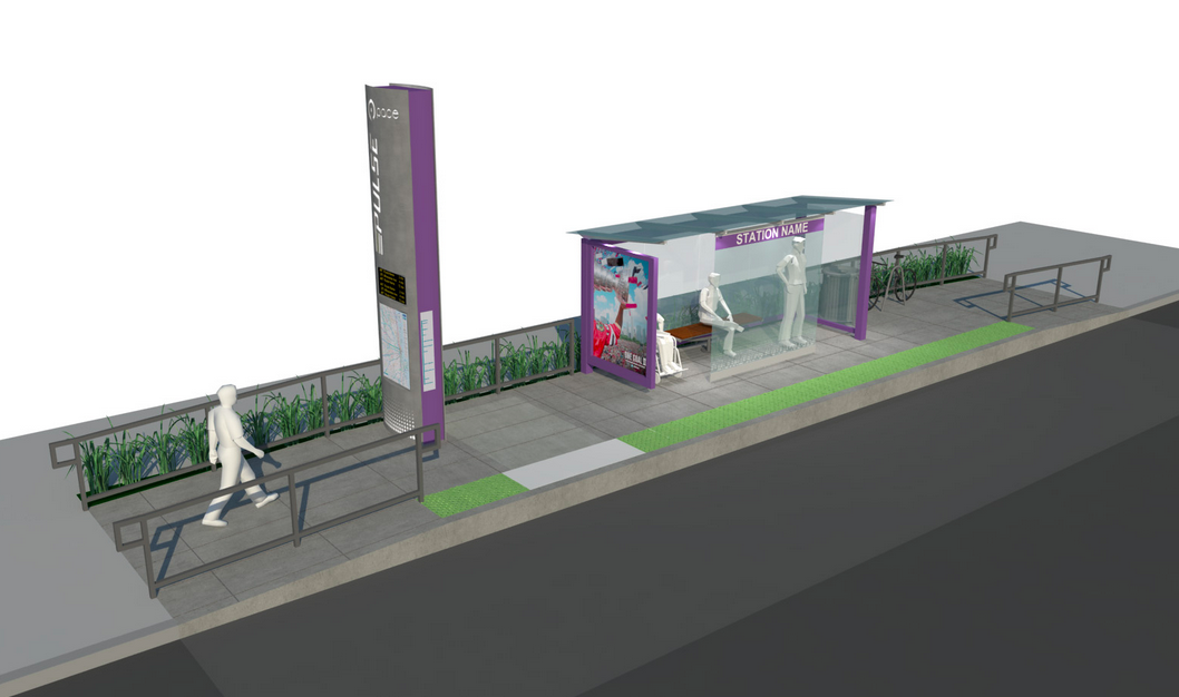
5. Streetcars

Ballpark Cost: $50 million per mile

While subways are potentially useful but logistically impossible, streetcars are logistically simpler but, in most cases, their benefits are much more doubtful.

I should note that I’m using a very particular definition of streetcars here. I have in mind essentially a bus on rails: a relatively short train set designed to travel in the same road lane as cars and other traffic. (Another type of rail transit that some people might call a streetcar, but which I’m calling “street-running light rail,” appears further below.) It looks something like this:

16107801889_0da259e5ff_k

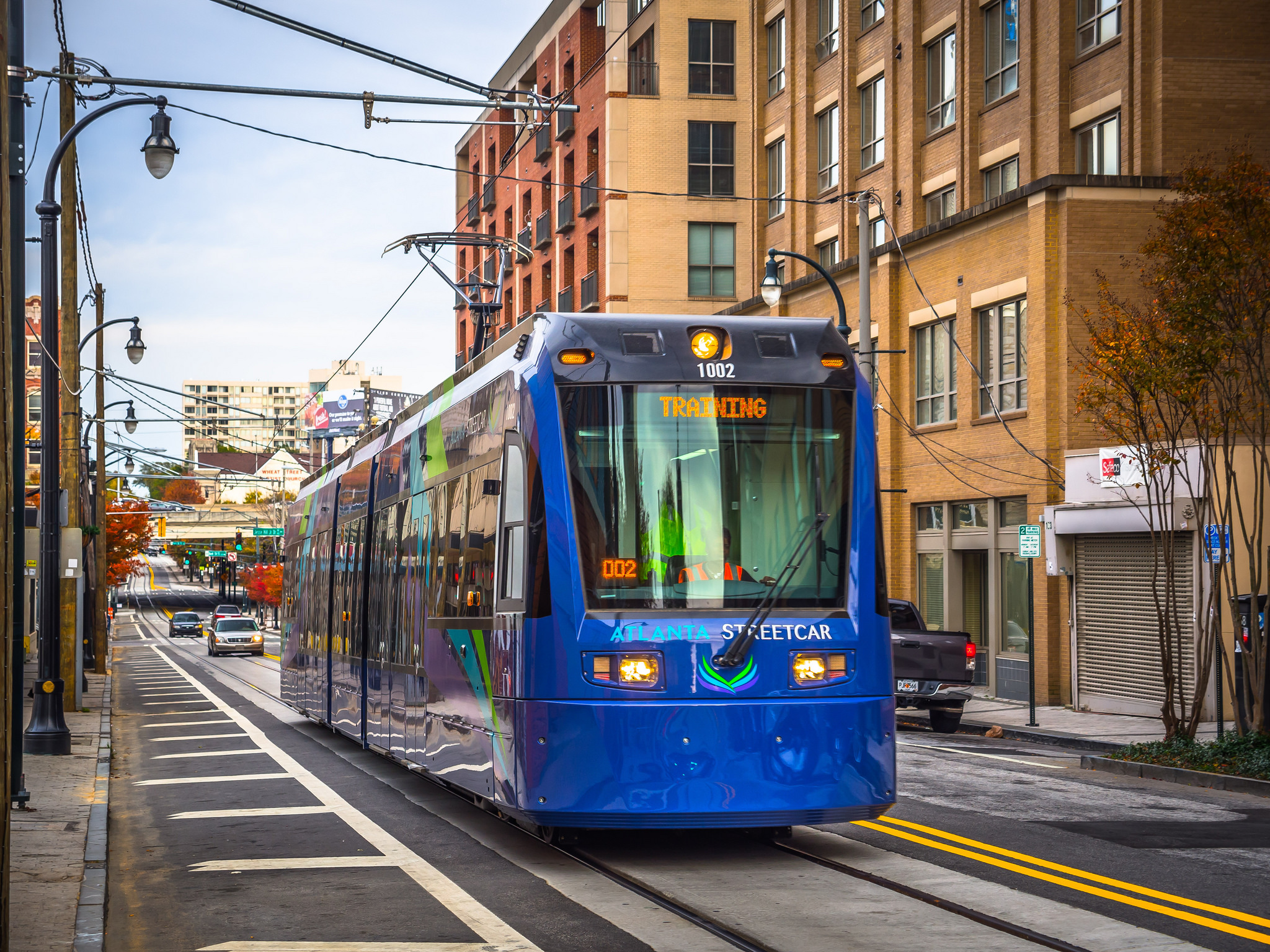
That’s the recently-opened Atlanta streetcar; note the automobiles in the same lane behind it. The problem with this sort of thing, from a Chicago-centric perspective at least, is that it has exactly the same issue that Chicago’s buses have: it gets stuck in traffic, and is therefore extremely slow. Actually, it’s worse than that: buses can move around a stopped cab or double-parked car; a streetcar can’t. In fact, one reporter found the Atlanta streetcar to be slower than walking.

The one advantage streetcars do have over buses is that they can hold more people. But that’s only an advantage if a) you need more capacity and can’t run any more buses, or b) you want to trade higher-capacity vehicles for less frequent service. Since there are virtually no bus lines on which the CTA can’t fit more bus runs – and since I don’t know of any Chicagoans who think that their local bus runs too frequently – those don’t seem super relevant here.

And, for all that, you have to spend $50 million – the cost of one of those super-fancy new L stations – to build each mile before you can even get up and running.

4. Freight right-of-way

Ballpark Cost: $180 million per mile

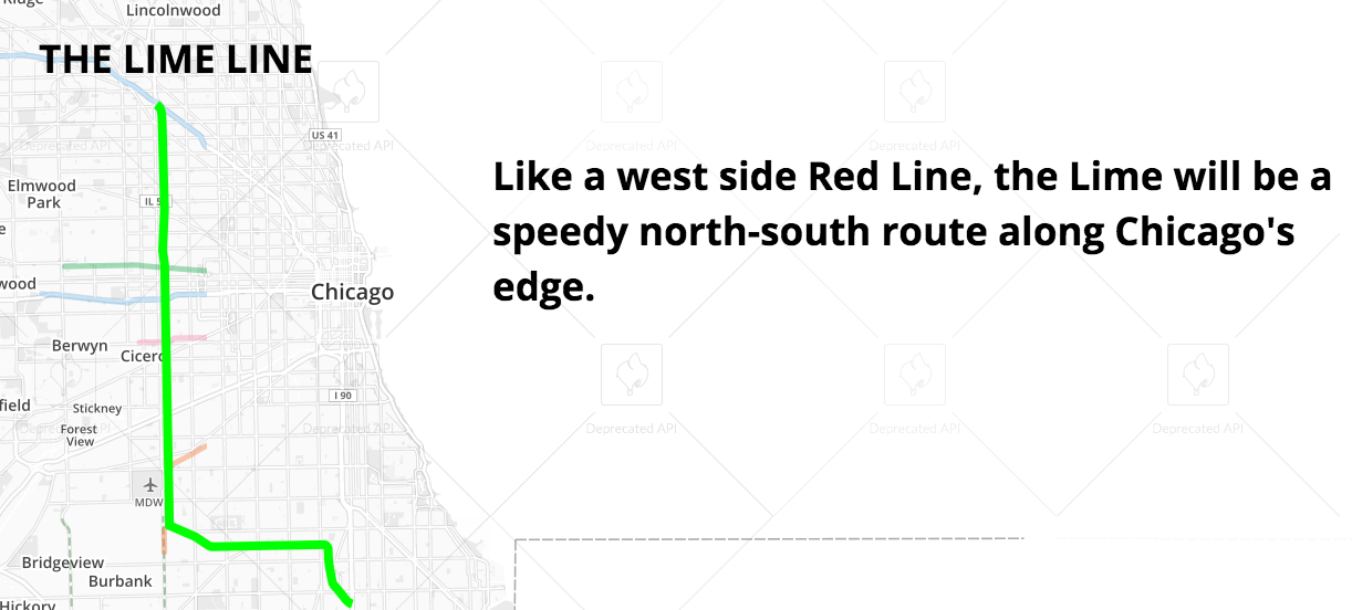
A cheap way to build a rail line that doesn’t have the traffic problems of a streetcar is to put it where there are already train tracks: in a freight right-of-way. That’s mostly what Chicago did with the Orange Line. There have also been proposals to create a line in a freight right-of-way just east of Cicero Avenue – the “Lime Line” in Transit Future.

Screen Shot 2015-05-10 at 7.29.50 PM

The problem with this is that most freight corridors don’t go near major residential or commercial nodes. Here, for example, is the area around the Kedzie Avenue Orange Line station:

Unlike L stations on, say, the Green or Brown Lines, you have to walk a quarter mile or more through some pretty uninviting landscapes to get to the places that most people take transit to get to. That problem can be partly mitigated by integrating the station well with frequent buses that take people for their last mile, and the Orange Line makes an effort to do so – but that can still easy add ten or fifteen minutes to a trip, making it much less attractive. That may have something to do with the findings of a study last year that the Orange Line has not catalyzed development in the way that other transit lines have.

3. Elevateds

Ballpark Cost: $250 million per mile

Credit: TheeErin
Credit: TheeErin

Elevated trains have some of the advantages of subways – they don’t have to even think about street traffic – but are missing lots of others. Namely: they’re exposed to the elements, and are considered by most people a bit of an audiovisual disaster. They’re much, much cheaper – enough so that one could imagine the city actually procuring the money to build one – but politically quite difficult to build in places where lots of people already live and have bought homes on the assumption that there would not be a train rumbling past every five to ten minutes all day.

But if you run them far away from where people actually live, then you have the same problem as freight right-of-ways: you’re not actually connecting people to where they want to go, which is usually the entire point of building a transit line.

2. Street-running light rail

Ballpark Cost: $160 million per mile

Credit: Ruin Raider.
The recently-opened Green Line in the Twin Cities. Credit: Ruin Raider

This is essentially a streetcar with its own travel lanes. Advantages, then, include that it can bypass traffic jams without incurring the expense of building either underground or an elevated structure; it also is much more likely to run near homes and businesses, as it runs in an actual street rather than a freight corridor.

Unfortunately, these kinds of projects can still have problems with speed, since they may have to stop for traffic lights, and being in the middle of a busy street means they can’t reach heavy-rail speeds (the L, for example, can top out at 55 mph – which wouldn’t be allowed if it were running down Western). Still, it’s cheap and user-friendly.

1. Commuter rail conversions

Ballpark Cost: $27 million per mile

Credit: Eric Allix Rogers
The Metra Electric District along Chicago’s south lakefront. Credit: Eric Allix Rogers

It’s a little-known but important fact that there are far more Metra stations on the South Side than there are L stations. Some Metra lines also have freight traffic that limits the number of possible passenger trains, but for the several that don’t – including the Metra Electric District – there’s no reason that these existing passenger rail lines can’t be turned into regular L-type service relatively easily. Make some upgrades, buy some train sets, and run them every ten minutes or so, and boom, you’ve got a new rapid transit line.

Of course, the bigger issue is political. But with Toronto promising 15-minute headways all day on its commuter rail network, it’s a shame there isn’t more momentum for that type of conversion here.

¹ In every case but commuter rail conversions, I’ve come to these cost figures by averaging all similar projects currently under construction in the United States, as listed at The Transport Politic. There are a lot of problems with this: mostly, construction costs are so site- and project-specific that it’s really hard to generalize to a particular development in Chicago from things that are being done elsewhere. But this was, I thought, about as good as I could do – thus the qualification that these are only “ballpark” costs.

In the case of commuter rail conversions, because there is not a single such project under construction in the entire United States (though there is in Toronto!), and because the most likely such project in Chicago – the conversion of the Metra Electric line – has been studied and given a price tag, I just used that.

How we measure segregation depends on why we care

Over at City Observatory, I have a post riffing on recent posts by Nate Silver and the New York Times’ Upshot on segregation and the reproduction of inequality:

That is, it’s easier to send black children to inferior schools if their schools are all on one side of town, and white schools are on the other. It’s easier to target housing and mortgage discrimination against blacks – one of the most important causes of the wealth gap – if all the black-owned houses are in one area. It’s easier to unleash abusive policing and incarceration practices on black communities without disturbing – or even attracting the attention – of whites for decades if whites and blacks don’t live in the same neighborhoods…. If this is why we care about segregation, then Silver’s measure – which doesn’t care which racial groups are mixing, as long as there is some mixing going on – is less useful. What matters then isn’t just integration: what matters is that privileged groups live in the same places as traditionally oppressed groups, so that place-based discrimination is made more difficult. In the United States, that means whites and people of color living in the same neighborhoods. Where that doesn’t happen – even if an area is integrated with, say, blacks and Latinos – then place-based discrimination is still viable, and it will be much easier to reproduce racial inequality.

Screen Shot 2015-05-04 at 12.28.27 PM

The Riots

Actually, given what’s going on in Baltimore right now – and the narratives it’s being fit into in a lot of places – I think I’ll republish an excerpt of a post I wrote back in 2013, before I really had any readers. I wouldn’t necessarily write this exactly the same way today, but I stand by the general idea.


All blockquotes are from Making the Second Ghetto by Arnold Hirsch, except where noted.

During the first two evenings of disorder, crowds ranging from 1,500 to 5,000 persons battled police who frustrated their attempts to enter the project. Mobs broke off their engagements with the police and assaulted cars carrying blacks through the area…. Blacks were hauled of streetcars and beaten. Roaming gangs covered an area…of nearly two miles…. An “incomplete” list…included 35 blacks who were known injured by white gangs, and the Defender reported that at least 100 cars driven by blacks were attacked. Eventually more than 1,000 police were dispatched to the area, and more than 700 remained in the vicinity a full two weeks after the riot had “ended.”

This post was originally supposed to be pegged to the Detroit bankruptcy postmortems, but I’ve been busy, and in any case the phenomenon at hand is hardly that specific.

The following weekend, one hundred and fifty white teens armed with metal rods and bottles rampaged through the park, injuring thirty black picnickers. “Hoodlums” broke the windows of more than twenty-five cars…. Officers refused to escort victims into the park to retrieve their belongings, left several black women and children stranded in a park building as the mob attacked, and again rebuked the picnickers for using the “wrong park.”

But that was a particularly stark moment, since it called on all sorts of people to recount a narrative of northern urban decline. And pretty much every single one I read said something like this, from the Boston Globe: “Detroit’s deterioration, which started in earnest after the 1967 race riots were among the most violent in the country’s history, has accelerated in recent years.” Or this, from NPR: “In the 1950s and ’60s, the car companies started moving factories from the urban core to the suburbs. Many white families followed, but discriminatory practices blocked that option for black families. As a result, Detroit got poorer and blacker, while the suburbs got richer and whiter — especially after the city’s 1967 riots over race and income disparities.” Searching for Detroit AND bankruptcy AND riots gets you over two and a half million hits on Google.

This sounds familiar, if you’re a Chicagoan. Chicago Magazine, in fact, published a post in the aftermath of the bankruptcy entitled “How Highways and Riots Shaped Detroit and Chicago,” which declares that the 1968 riots in the latter city “didn’t have the effect of Detroit’s (much deadlier) riots on the whole of the city, but it did permanently damage whole swaths of it while changing the commercial and racial makeup of the city.” It quotes another article: “Marie Bousfield has worked for Chicago’s Planning Department…for 15 years. ‘It’s my view that the riots were the cause of what you call “white flight,”‘ Bousfield told me recently, though she was quick to add that that’s only her personal feeling…. She is certainly not alone in believing that the riots were at least partly responsible. There’s no doubt that there was a dramatic increase in white flight…during the early 70s.”

The 1971 school year opened with the bombing of ten Pontiac[, Michigan] school buses, followed by mass protests…. [White] antibusing activists…vandalized school buses, puncturing radiators with sharpened broomsticks, breaking windows with stones and bricks, and forcing the district to create a high-security parking lot, complete with a bulletproof watchtower. Sweet Land of Liberty, Thomas Sugrue

This is something like a Big Bang theory of urban violence. There were always problems in American cities, the theory says. There were pressures. The seeds of disaster. But the riots of the 1960s, when black people looted and burned entire neighborhoods – their own, but no one at the time could be sure they would stay there – was the catalytic event that actually delivered chaos and unchecked violence. It was the moment when ghettoes like Detroit, or the West Side of Chicago, were born. The things I couldn’t explain from the other side of my train window – those are the “scars” (as the preferred metaphor goes) of the riots.

Monroe Anderson [Tribune reporter] It was almost a riot. When Harold [Washington] showed up and the press entourage showed up, there was this angry– people were approaching the car. People were out of control. I thought that we were in physical danger. And then we get to the church, and somebody spray-painted, on the church, graffiti that said, “Die, nigger, die.”

Ira Glass On a Catholic church?

Monroe Anderson Yes.

This American Life, Harold, describing events at a campaign stop by Chicago’s first black mayor, in 1983.

To get to the point, this is a theory that is tenable only because we have decided to eliminate all other forms of racialized violence from our collective history. When we talk about “the riots,” context is unnecessary: it is understood that we are talking about blacks, in the 1960s (or, maybe, the early 90s in LA), burning and looting the neighborhoods where they lived. As a result, we don’t even have a word for the things that we don’t talk about. We don’t have a word to talk about white mobs burning buildings in Northern cities, or beating or killing innocent people, who wanted to move into their neighborhoods. We don’t really have a word for this:

Estimates of the Englewood crowds varied from several hundred at the riot’s inception to as many as 10,000 at its peak. “Strangers” who entered the area to observe the white protestors and innocent passers-by…were brutally beaten.

Or this:

A crowd of 2,000 descended upon the two-flat bought by Roscoe Johnson at 7153 S. St. Lawrence…. They started throwing gasoline-soaked rags stuck in pop bottles. They also threw flares and torches.

Or this:

In Calumet Park, as dusk fell on the scene that saw whites attacking cars occupied by blacks, white handkerchiefs appeared on the antennas of cars driven by whites so that, in the diminishing visibility, the rioters would suffer no problems in selecting their targets.

Or this:

A mob of 2,000 to 5,000 angry whites assaulted a large apartment building that housed a single black family in one of its twenty units. The burning and looting of the building’s contents lated several nights until order was finally restored by the presence of some 450 National Guardsmen and 200 Cicero and Cook County sheriff’s police.

Or this:

When a black family moved to suburban Columbus in 1956, whites greeted them with a burning cross and cut telephone wires.

Or this:

From May 1944 through July 1946, forty-six…residences were assaulted [in Chicago] (nine were attacked twice and one home was targeted on five separate occasions)…. Beginning in January 1945 there was at least one attack every month…, and twenty-nine of the of the onslaughts were arson-bombings. At least three persons were killed in the incidents.

But they all happened, and they deserve to exist, at least, in our collective memory.

And more than that, the white riots – the 48-hour flash-bang ones, and the slow-burn, once-a-month terrorist bombings – deserve to have as prominent a place in the narrative of northern urban decline as the black riots currently enjoy. Not to make white people wallow in guilt, or even to “blame” them (although those who participated, many of whom are still alive, probably should feel pretty bad about it, if they don’t already), but because any discussion of “what went wrong” that doesn’t mention white violence is just woefully incomplete, and yet that is pretty much the only discussion that we have. It’s like analyzing the causes of World War Two without having heard of the Treaty of Versailles.

Without this context – without the knowledge that the advent of black people to previously all-white urban neighborhoods caused a total breakdown of public safety pretty much immediately as a result of these white mobs – none of what we see in the ghetto makes sense. So we have to invent a narrative to explain it, and we tell stories about how black people burned down their own homes and businesses, and maybe, depending on our politics, about a “culture of poverty” or “welfare dependence.”

We also, of course, tell a story about economic devastation wrought by de-industrialization, automation, and offshoring jobs. But we never explain why black neighborhoods seem to be overwhelmingly the ones that are decimated, while the white ghetto, as a northern urban phenomenon, is practically unknown. True story: cross-racial comparisons of social indicators like teen pregnancy and street crime that control for neighborhood poverty are impossible in most large American cities, because there are no white neighborhoods as poor as the black ghettoes.

But if whites were so freaked out by the arrival of black people that they bombed their houses and even the buses that their children went to school on, maybe it makes sense that they (consumers and bankers) also pulled every dollar out of the commercial life of their neighborhoods when they decided they had lost the battle against their black neighbors. Maybe it makes sense that these places became as shunned and isolated as they did.

With this context, the black riot-Big Bang theory of urban violence becomes absurd. In the 1950s – years before Watts, or Detroit, or the King riots – Philadelphia lost a quarter of a million whites. Chicago lost 400,000. Detroit lost 350,000. The scale of the abandonment, as with the anti-black violence, was massive from very, very early on.

The web of political and economic and social causes that brought about that abandonment is, of course, extremely complex. I am not suggesting here that white violence was the only, or even overriding, cause. I am suggesting, however, that a conversation about urban decline without it is impossible, both because it was important in its own right and because it illuminates so many of the other causes.

The Simplified Chicago Residential Zoning Map

Click to go to the interactive map!

One of the most under-appreciated aspects of Chicago’s housing system – although, thankfully, it’s becoming more well known – is how radically the city restricts the kinds of housing that can be built in the neighborhoods. Forms of housing that are traditional all over the city, and that provide subsidy-free affordable housing for working class people, are illegal nearly everywhere outside of downtown and the lakefront. In fact, the vast majority of Chicago neighborhoods are zoned so that the only legal form of new housing is the single-family home – which in many places will necessarily be out of reach for moderate-income people. This is true even in neighborhoods, and on streets, where two-flats, three-flats, and other apartment buildings already exist. Essentially, we’ve imposed classic suburban exclusionary zoning in North Center, West Town, and elsewhere.

But it’s hard to visualize these restrictions, because they come in the form of incredibly arcane and detail-laden laws that no one ever reads, and couldn’t understand if they did. One way that I like to get to the bottom line of what the zoning code means for housing is to measure the number of housing units allowed per standard 125′ by 25′ city lot. That strips away all the various design issues and gets down to a basic measure of density: how intensely can this land be used? By (roughly) how many people?

So, in the interest of zoning readability, I’ve made an interactive map that shows how many residential units are allowed by the zoning code in any given place in the city. Look up your block! Look at streets around L stations! They’re mostly zoned very, very tightly.

For example, this street is literally a block and a half from a Brown Line station, is already build up with 3 1/2 story apartment buildings, and is zoned for single family homes only.
For example, this street is literally a block and a half from a Brown Line station, is already built up with 3 1/2 story apartment buildings, and is zoned for single family homes only.

Now, because this is so simplified, I feel the need to make a few caveats. First, if you’d like to get some more details about what these zones allow, but in a more readable format than the actual city code, go to Second City Zoning. Second, here are some things you should know before you use the map:

1. The Simplified Chicago Residential Zoning Map is residential. That is, it doesn’t show zoning in places that only allow non-residential uses, and it won’t show non-residential uses on lots that allow both. Especially along major streets, many zones allow, say, one residential unit above a storefront. If you see that a lot is zoned with a code that begins with B or C, you can mentally add “stores” to the list of uses allowed, in addition to however many residential units.

2. Zoning in Chicago is extremely ad hoc. In practice, that means that virtually every sizable development involves a zoning variance or planned development process that goes beyond the zoning you’ll see on the map. In one sense, that’s good, because it gives the zoning code some flexibility; on the other, it means that development doesn’t follow any kind of plan, and each new development must relitigate the battle over density with the neighbors. That deters an enormous amount of construction – especially the sort of small-bore densification that should be the bread and butter of a healthy city. A developer working on a 200-unit project is going to make enough money to justify going through several public meetings over the course of months; someone who just wants to build a four-flat on a single-family-home-zoned parcel is probably not.

3. Not all units are created equal. Depending on other regulations in the zoning code – height, floor area ratio, parking – as well as, of course, the market, a new building might be made up mostly of studios or three bedroom units. Unit size, in turn, will obviously determine how many people live in each unit, and thus the whole building. So it may be that a 10-studio building has fewer people than another building with four three-bedroom units.

4. It’s interesting to note which parts of the city aren’t tightly zoned, outside of downtown. Mostly, it’s black neighborhoods on the West and South sides. Of course, with the exception of parts of Bronzeville, there isn’t enough demand to warrant new construction in most of these places anyway – but that, I would like to suggest, is part of the point. It hasn’t come up. Historically, downzoning on the North Side has followed the arrival of denser building.

I think that’s it. Enjoy!

City Observatory

Screen Shot 2015-04-13 at 10.04.55 AM

As of last week, I’ve joined City Observatory as a Senior Fellow. For those of you who don’t know it, City Observatory is a new Knight Foundation-funded urban policy think tank run by Joe Cortright. It’s been around for less than a year, but in that time it’s garnered national media coverage with three major reports and regular contributions to the online conversation about cities and opportunity. They’ve already made a name for themselves as an important and smart part of the urban policy world, and I’m really excited to join as CO grows.

I’ve written a sort of introductory post at City Observatory; if you’re a regular reader here, I don’t think there will be anything surprising in it, but it lays out, from something close to first principles, why I care about all this stuff.

Also: I will still be writing here, but probably somewhat less, and probably (even) more Chicago-centric things, since my stuff at CO will mostly be national in scope. I hope you’ll follow me over to City Observatory not only to read my stuff, but also that of my new colleagues.

And finally: Thanks to everyone who’s been reading me here. Like many of the coolest things I’ve gotten to do over the last year or so, I got my position at City Observatory largely because of this blog, and that’s pretty awesome. Looking forward to more.

Edit: Some people have asked for the RSS feed for City Observatory’s blog, which is here: http://cityobservatory.org/feed/

The changing rules of segregation in Chicago: or, a Chinatown grows in Bronzeville

NPR's Code Switch
NPR’s Code Switch

A letter published last summer in the Chicago Tribune asked for a second look: “When you see us coming, you might hurry and get in your car and lock your door. Then speed through these streets at 60 mph like you’re on the highway, trying to get out of this ghetto. [But] we want you to know us.”

The authors were a class of fifth graders from the South Shore neighborhood, just a few miles down the coast of Lake Michigan from the University of Chicago. Like many Rust Belt communities, South Shore has its share of problems. But it also has ornate Jazz Age apartment blocks and large, stately homes; it has skyline views from its beaches, and the brilliant ballrooms of the Cultural Center, where Barack and Michelle Obama held their wedding reception. By express bus or commuter rail, it’s just over half an hour to downtown jobs.

If South Shore were in New York or DC, in other words, it would be exactly the type of place you’d expect to be suffering from too much attention, rather than too little.

But just a few weeks after the Tribune letter was published, two Harvard researchers confirmed statistically what many residents had known, or suspected, for a long time: in Chicago, black neighborhoods like South Shore just don’t gentrify.

South Shore Drive. Credit: Eric Allix Rogers

In fact, it goes much farther than that: they don’t undergo any kind of ethnic change at all. Robert Sampson, one of the researchers, coined the term “white avoidance” to describe the phenomenon of whites simply refusing to move to neighborhoods where more than 40% of the residents are African-American. (Though it’s worth noting that there are actually quite few Chicago neighborhoods at that 40% level: most have either small African-American populations, or are over 90% or 95% black.) But Chicago’s rapidly growing numbers of Latino and Asian-American residents have been steering clear, too. Between 1980 and 2000, the only majority-black neighborhoods to see significant integration were Cabrini-Green – where a major public housing project began transitioning to mixed-income developments that included high-end condos – and the South Loop, whose train yards, warehouses, and convention centers presented more of a blank slate for redevelopment than a cohesive neighborhood.

At the same time, Chicago’s white neighborhoods underwent a profound racial transformation. The far Northwest Side neighborhood of Jefferson Park is typical. In 1980, it was as homogeneously white (97%) as South Shore was black. But by 2000, nearly one resident out of five was a person of color. By 2010, that was up to almost one in three.

These trends – demographically frozen black neighborhoods and rapidly integrating white ones – changed a city that had been profoundly and neatly segregated into one defined by asymmetrical segregation. While Asians, Latinos, and whites are far from perfectly mixed, there are many neighborhoods where they live together. For black households, on the other hand, ethnic isolation remains the rule.

On both counts, though, those trends may be changing.

BlkInt80BlkInt90BlkInt00

Since 2000, for the first time in Chicago’s history, people of other ethnic backgrounds appear to be moving into black neighborhoods in nearly every region of the city except the far South Side. To be clear, in many cases the change amounts to just a few percentage points of a neighborhood’s overall population: notable only because the previous rate of change was zero. But dramatic transformations in other places began with a trickle, too. If one of the cardinal rules of residential migration in Chicago is actually weakening, it may open up the possibility of broader demographic change across the city’s South and West Sides in the medium to long term.

Moreover, the changes are much more complex than the familiar narrative of white-led gentrification. As often as not, the newcomers are Latino or Asian-American. Not surprisingly, this seems to depend on the demographics of the neighborhood next door: on the West Side, where black communities bump up against Mexican and Puerto Rican districts to the north, these new residents are mostly Latino. Northern Bronzeville, close to Chinatown, has a rapidly growing Asian-American population. And the communities around Hyde Park – a racially mixed neighborhood with a large number of white residents – are, in fact, getting slightly whiter.

BlkIntSouth3 BlkIntWest3

But while Chicago’s black neighborhoods take a few tentative steps away from extreme segregation, some of the city’s white neighborhoods are moving in the opposite direction. Over the last 30 years, as a broad swath of the North Side has gentrified, it has also become disproportionately white. It now seems that nearly as many white North Side neighborhoods are becoming more segregated as are becoming less – a dramatic reversal from recent trends.

WhtSeg80WhtSeg90WhtSeg00

At first blush, this seems like a contradiction: why would some parts of the city be getting more segregated as others become somewhat more integrated? Most likely, however, they’re both part of the same broader phenomenon.

For the last few generations, Chicago’s economic geography has resembled a growing donut. In the center is a small, but quickly expanding, core of wealth. As the core grows, a surrounding ring of low-income neighborhoods gets pushed further out. And those neighborhoods, in turn, elbow aside a suburban ring of wealthier communities, which also move away from the core.

For various reasons, including the racial income and wealth gaps, neighborhoods that get absorbed into the rich core become much whiter, explaining the growing segregation there. But as that disproportionately white sector expands, it also helps to push the residents of neighborhoods in its path further out – and, in some cases, into black communities.

Still, that’s probably not the whole story. Ethnic communities, from Poles to Mexicans, have been moving increasingly far from the city center for many generations; only recently have some of them ventured into black neighborhoods. While research like Robert Sampson’s shows that “white avoidance” remains a powerful force, other academics have found evidence that white tolerance for black neighbors has (very slowly) inched up over the last few decades. That might also help to explain the sort of very tentative integration along the boundaries of black neighborhoods that Chicago is now experiencing.

The eastern and northern sides of East Garfield Park, on the West Side, have been seeing a notable amount of demographic change. Credit: Eric Allix Rogers

It’s harder to guess at whether these trends – if they grow and continue – are likely to make a famously unequal city a bit more just. Of course, the increasing racial and economic segregation of the core is a huge problem. Would declining segregation in historically black neighborhoods provide a counterbalance? Maybe. But longtime residents who have grown accustomed to living in a neighborhood with a particular community and culture have every reason to be wary of losing those things. And particularly where the newcomers are white – mostly along the borders of Chicago’s growing wealthy core – gentrification may eventually become a reality, and integration may be a passing phase.

Perhaps the most promising trend, then, is the movement of Latinos and Asian-Americans into black neighborhoods – particularly ones that have been losing population as residents move to the suburbs or southern cities. For many shrinking white neighborhoods around the Rust Belt, Latino and Asian immigrants, and their American-born children and grandchildren, have brought a much-needed economic and demographic shot in the arm. If black neighborhoods in Chicago can enjoy those benefits too, it may provide a path towards community development that doesn’t require rapid gentrification.

At the moment, of course, this all remains conjecture. A few bricks may have come loose from the structure of Chicago’s segregation, but the fortress remains. It will be a very long time before it’s gone.

Return to the shrinking North Side

Almost every time I publish, I have a very unpleasant, very intense fear that despite my best efforts, I have written something wrong and stupid in some obvious way. The most pleasing part of the writing cycle for me, then, is when either a) no one argues that what I wrote was wrong or stupid, or b) someone argues that what I wrote was wrong or stupid, but is clearly wrong themselves. (Of course, it’s also deeply satisfying to see someone respond critically in a way that expands my understanding of an issue without making me feel that I’ve somehow embarrassed myself or offended someone.)

My recent post on the wasted demographic and tax-revenue potential of Chicago’s North Side, which was republished last week in Crain’s, received two sustained counterarguments: one from Joe Zekas at YoChicago, and one from the real estate broker Eric Rojas. It’s fair to say that I find neither of them very convincing.

Joe’s argument is essentially that Lincoln Park isn’t really losing people, because a) it was growing up until 2000, b) its decline in the 2010 Census was small (about 200 people), and c) the small loss is turned into a small gain if you don’t count the emptying out of CHA’s Lathrop Homes on the far western edge of the neighborhood. To which I would reply that a) is pretty weak, given how long ago the 90s were, and I guess b) and c) are fair as far as they go.

But the argument was never about whether Lincoln Park’s population trend was slightly above or slightly below zero. It was, rather, that there is room for lots more housing in Lincoln Park, given that its population remains roughly 40% below its peak, and that it had fewer housing units in 2010 than it did ten or twenty years earlier; that there is obviously a desire for that housing; and that by refusing to allow the construction of that housing, we’re starving the city of people and money that it desperately needs. Nowhere in his response does Joe Zekas address any of those points, which makes it hard to even see his post as much of a rebuttal.

Eric Rojas’ post is not much stronger. His first objection is that, you know, life’s not fair:

The Crain’s author makes a lot of assumptions, and in my opinion, is unrealistic in terms of accessibility of real estate in general.  It is unrealistic for anyone to be able to afford any community they desire at any given time. This goes for tony suburbs and vacation spots as well.

Which may be true! And yet it’s also a bit odd, given that I was proposing not a utopian community in which we exchange luxury rental units for hugs, but a tweak in the zoning code to return to a level of restrictions on building that prevailed within the lifetime of a middle-aged person. Moreover, as I’ve pointed out before, the issue is not simply that, on a fair playing field and an impartial, “free” market, some people happen to be doing better than others, and so they can afford better real estate. The issue is that the playing field is tilted against those of more modest income, and the zoning laws of the last 40 years make housing more expensive than it has to be. Life may be unfair, but in this case, it’s unfair because we’re cheating.

Rojas continues:

There are no statistics cited correlating Lincoln Parks population “decline” (again, it’s actually increased from 1980-2010 by 12% and has lost only 206 people from 2000-2010 according to YoChicago.com) with a decline of tax base or sapping resources for the entire city.  There are no statistics cited that suggest Lincoln Park was better off when it’s population was around 100,000 in 1950 rather than with today’s steady 64,000. [emphasis in original]

One by one:

  • Hiding the decline/stagnation of the most recent decade by combining it with the two previous ones is not super honest. Moreover, a 12% increase over 30 years represents a growth rate of something like 0.4% per year, which is hardly breakneck speed, and considerably below the growth rate of the metropolitan area as a whole. And, again, the most recent numbers we have put the current growth rate much closer to zero. And, again, Lincoln Park’s population remains 40% below its peak, despite the fact that it is among the most desirable urban neighborhoods in the country.
  • If Mr. Rojas really doesn’t think that more people and housing leads to more tax revenue, I’d refer him to the recent battle in Crain’s over TIFs, which explains how new development deposits money more or less directly into the city’s, and CPS’, bank accounts. (In short: the city can receive more money with the same tax rate, and CPS can go above state-mandated caps on its tax collections if it does so by taxing new development.)
  • Finally, the last sentence would be relevant if I were proposing to bring Chicago back to the 1950s, or if the only thing that had changed about Chicago between 1950 and 2015 was that Lincoln Park had lost population. But obviously neither of those things is true. Lincoln Park was much less segregated by income in the 1950s, which was good; it also had a lot of other problems, all of which were tied up in the broader urban trends that dominated America at the time.

In conclusion, I stand by my original piece and its argument.

Sometimes things are nice

Very  briefly, before a trip to China (yay!):

1. December 2014 was the first month of year-over-year ridership growth for CTA buses since November 2012. (Zero point one percent growth, but you know, it’s the trend that counts.) January 2015 was the second. (5.6% – though from a very low baseline of Polar Vortex-ified January 2014. Still down from January 2013.) Eagerly awaiting later numbers to see if this is a turnaround that will stick.

2. Pace, Chicago’s suburban bus service, has launched the website for Pulse, its rapid bus network initiative. Eventually, Pace plans 24 routes throughout the six-county area – though mostly serving suburban Cook. The first two lines to be implemented will be along Milwaukee Avenue, going northwest from the Jefferson Park Blue Line station, and Dempster Street, from Evanston to O’Hare.

The lines will have stops roughly every half mile, raised stations with real-time arrival information and heating, and limited transit-signal technology to give the buses priority through traffic lights. (Though only when it doesn’t affect car traffic, which is a pretty big “only.”)

The most important thing, though, might be the frequency, which is planned for every 10 minutes during peak periods and 15 minutes the rest of the day. Fifteen minutes is the outer edge of acceptable, but for a suburban bus network, it’s pretty exciting. Kudos to Pace.

Rendering of a Pulse station.

Unnecessary population loss on the North Side is a problem for the whole city

Here’s one way to put Chicago’s demographic problem: Since 1950, the city has lost more people than currently live in all of San Francisco, Boston, or D.C. After finally increasing its population in the 1990s, the 2010 Census found that Chicago – unique among the large, relatively prosperous cities we consider our peers – had declined by 7%, or around 200,000 residents.

Indeed, just a couple miles from the heart of the Loop lies a neighborhood that, despite a rich history, beautiful architecture, and quick access to the second-largest business district in America, has lost 40% of its population since the middle of the last century. An area that once held 102,000 people is now home to barely 64,000.

That area is called Lincoln Park.

For a long time, most accounts of Chicago’s lagging population have focused on parts of the South and West Sides where many residents, largely African-American, have decided to decamp for the suburbs or the South in search of better schools, less crime, and more jobs.

But the under-appreciated flip side of population loss in those parts of the city is that places that ought to be growing like gangbusters are stagnant, often sitting 25% to 50% below their peak populations. Lakeview, for example, was once home to 124,000 people; its population is now 94,000. North Center is down from nearly 49,000 to under 32,000. West Town, which includes Wicker Park and Bucktown, has fallen from 187,000 to 81,000.

Decline5010


Seg12aCompare the maps: many of Chicago’s wealthiest neighborhoods are dramatically below their peak populations.

Even more startling, these areas aren’t necessarily gaining back those people. Lincoln Park, Lakeview, and North Center all actually lost population in the 2000s. Logan Square, whose rapid ascent as a “hot” neighborhood picked up steam during that decade, was home to 11% fewer people in 2010 compared to ten years earlier.10

The problem, obviously, is not that people don’t want to live in these neighborhoods. Home prices and rents have skyrocketed over the last ten to twenty years; average incomes have climbed with them, as more and more of the well-to-do decide Chicago’s North Side is a place they’d like to call home.

So what’s going on? And why should we care?

One reason is that over the last few generations, Americans all over the country have spread out a bit: apartments that used to hold a family of five or six now contain a family of three or four – or maybe a childless couple who have turned a bedroom into an office. Or maybe just one person, living alone. This is especially true in wealthier areas, where people can afford to buy themselves more space. As a result, if a neighborhood has roughly the same number of housing units it had fifty years ago, it probably has a significantly lower population.

But that doesn’t explain why these neighborhoods, which have become so popular, haven’t seen the construction of more housing units. For most of Chicago’s history, when a neighborhood became more popular, builders created more housing, turning houses into three-flats, and three-flats into courtyard buildings. In a few really high-demand areas, like right along the lakefront or near downtown, they might even have built highrises.

Note that outside of the central area, high rates of housing construction exist mainly along the river - along the western border of Lincoln Park and North Center. Many of those areas were formerly non-residential. Small amounts of new construction translated to high percentage growth.
Note that outside of the central area, high rates of housing construction exist mainly along the river – along the western border of Lincoln Park and North Center. Many of those areas were formerly non-residential. Small amounts of new construction translated to high percentage growth.

But for the last several decades, increasingly strict zoning laws have outlawed this kind of gradual build-up. Instead, Chicago’s laws allow a massive boom in parts of downtown – mostly where there weren’t enough white-collar residents to complain – while putting a tight lid on the neighborhoods.

Since replacing a couple two-flats with a courtyard building is now illegal, developers make money by tearing down an old two-flat and building a luxury two-flat in its place. Or they build a mansion, and the neighborhood actually loses a housing unit. As a result, as a neighborhood becomes more attractive, the city encourages fewer people to live there.

And that’s how we arrived at the bizarro-world reality that Lincoln Park actually lost roughly the same number of housing units as Englewood between 2000 and 2012.

You can see how dramatic the effect is by looking at population growth around the borders of downtown: where relatively loose downtown zoning holds sway, the number of residents boomed. But instead of gradually tapering off as you get further away, there are sharp drop-offs all around the central area. Often, a few blocks where the population grew by 50% or more are right next to a few blocks where population actually declined. In most cases, zoning plays a crucial role in those disparities.

But so what? Why does any of this matter?

For one, it matters because if the number of housing units in a neighborhood is capped, as that neighborhood becomes more desirable, affluent new arrivals will outbid existing residents and people of moderate income, pushing up housing prices and creating newly segregated enclaves. If we want regular people to be able to live in some of our safest, most transit-accessible neighborhoods, allowing the supply of housing to grow with demand is a crucial part of that affordability.

Second, as places like Lincoln Park become forbiddingly expensive, some people decide their next best option is, say, Wicker Park or Logan Square. When they arrive, they open coffee shops and hipster bars, attracting people with more money, who then bid up housing prices there, expanding the parts of the city where the working class simply can’t afford to live.

But most potential residents will just decide to move to the suburbs. And, once there, they won’t be supporting neighborhood businesses. They won’t be contributing to the city’s tax base. In other words, by pushing people to the suburbs, we’re giving up neighborhood jobs and money the city desperately needs to provide services in every neighborhood in the city, including – especially – the ones that are actually struggling, far from Lincoln Park.

The fact that Chicago’s affluent North Side communities have lost so many people, and aren’t gaining them back, is a huge problem for many local businesses, current residents of moderate means, and anyone who would like to move there but can’t afford to.

But even if none of that describes you, it’s also a problem for those of us who’d like to see City Hall have more resources to invest in other parts of the city, from policing, to schools, to transit, to road repair. It’s a problem for those of us who’d like to see more jobs created within commuting distance of Chicago communities where unemployment is endemic. It’s a problem, in other words, for all of us.